Luk Keng to Pat Sin Leng Trail in Tai Mei Tuk
Approx: 7~8 km
The EXACT trail for us:
(But this one just vice versa, started from Tai Mei Tuk to Luk Keng)
http://hk.myblog.yahoo.com/trackhiker4/article?mid=2572
http://hk.myblog.yahoo.com/Mountain-Yuen/article?mid=42526
交通 Traffic:粉嶺火車站A3 出口 56K 小巴, 鹿頸村總站下車
Minibus no. 56K from Fanling Railway Station (Exit A3), get off @ the destination outside Luk Keng Village
(粉嶺火車站→沙頭角→鹿頸黃屋→鹿頸陳屋→尤德紀念亭→下七木橋→上七木橋→橫山腳上村→橫山腳下村→大尾督)
(Fanling Railway station→Sha Tau Kok→Luk Keng Village [Wong Uk]→Luk Keng Village [Chan Uk]→Sir Edward Youde Memorial Pavilion→Lower Tsat Muk Kiu Village [Ha Tsat Muk Kiu]→Upper Tsat Muk Kiu Village [Sheung Tsat Muk Kiu]→Upper Wang Shan Keuk village [Wang Shan Keuk Sheung Tsuen]→Lower Wang Shan Keuk village [Wang Shan Keuk Ha Tsuen]→Tai Mei Tuk)
經過路線 Trail pass through:
衛奕信徑第10段
The Wilson Trail Stage 10
http://www.hkwalkers.net/eng/pdf/longtrail/wtrail/wmap10.pdf
(衛奕信徑第10段地圖~~ Official map for Wilson Trail, stage 10)
注意 Note:
基本上會以衛奕信徑第10段路線為準.
不過起步點會是鹿頸陳屋村村口旁的小路, 上山至尤德爵士紀念亭.
然後從尤德爵士紀念亭開始, 經衛奕信徑第10段下山 (即橫七古道)
Basically we'll follow the trail stated in the map, but still w/ some differences.
The start point will be from "Luk Keng Chan Uk" for us, rather than from Nam Chung as stated in the map.
We'll walk via a path near the entrance of Luk Keng Chan Uk which ends at "Sir Edward Youde Memorial Pavilion", and then enter the path for Wilson Trail stage 10.
解散點 Various points to dismiss:
(1) 新娘潭(最短路線) To Bride's Pool (the shortest path)--
終點在橫山腳下村, 經新娘潭自然教育徑下山至新娘潭.
於新娘潭有九巴275R 巴士至大埔火車站
From Wang Shan Keuk Ha Tsuen (Lower Wang Shan Keuk village) ~ there's a path leading to Bride's Pool Nature Trail, KMB bus no. 275R is available for going back to Taipo Railway station.
(2) 大尾督 To Tai Mei Tuk--
在衛奕信徑第10段的W127 標柱附近, 有指示牌指出往八仙嶺自然教育徑的方向.
可經小徑下山至大尾督乘坐往大埔火車站的巴士或小巴.
Near distance post W127 ~ There's a path leading downwards to Pat Sin Leng Nature Trail, and then just one-way down to Tai Mei Tuk for a bus or minibus to Taipo Railway station.
(3) 上至仙姑峰(海拔511米), 再下至大尾督 To the Top of Mt. Hsien Ku Fung (511 metres above sea level) and then Back to Tai Mei Tuk (the most challenging!)--
在衛奕信徑第10段的W127 標柱附近, 有指示牌指出往衛奕信徑第9段的方向, 那裡可接連仙姑峰, 亦可一試登頂. 然後回程至八仙嶺自然教育徑, 經小徑下山至大尾督乘坐往大埔火車站的巴士或小巴.
Near distance post W127 ~ There's another path leading to Wilson Trail Stage 9, which will also bring you to the top of Mt. Hsien Ku Fung. Reach the top and then back to the way you walk from, and then go down for Pat Sin Leng Nature Trail (same as point 2), and ends at Tai Mei Tuk.
(2) & (3) 皆會經過八仙嶺的春風亭
You can see "Spring Breeze Pavilion" @ Mt. Pat Sin Leng, for both (2) & (3)
http://en.wikipedia.org/wiki/1996_Pat_Sin_Leng_wildfire
(About "Spring Breeze Pavilion")
http://zh.wikipedia.org/zh-hk/1996%E5%B9%B4%E5%85%AB%E4%BB%99%E5%B6%BA%E5%B1%B1%E7%81%AB
(春風亭的由來: 1996年八仙嶺山火)
~ For trail ref:
http://www.phomon.com/ckli/bamboo.html
More reference can be found from :
https://sites.google.com/site/hikingphotohk/
Album:
http://www.fotop.net/medalene/05feb11wangtsat?page=1
http://www.fotop.net/medalene/05feb11wangtsat?page=2
http://www.fotop.net/medalene/05feb11wangtsat?page=3
http://www.fotop.net/medalene/05feb11wangtsat?page=4
http://www.fotop.net/medalene/05feb11wangtsat?page=5
http://www.fotop.net/medalene/05feb11wangtsat?page=6
http://medalene.blogspot.com/2011/02/wang-tsat-path.html


1015 來到沙頭角鹿頸村, 入村後步至村尾的公廁旁, 開始上山. 第一條支路向左上山.
J
We arrived Luk Keng Village @ Sha Tau Kok around 10:15am. Entered Luk Keng Village, walked till the end. You can find a public lavatory there, just walk along the footpath to go up.
Walk UPwards, from here, stick to the left first.


山路不平, 小心上行.
J
The mountain path is quite slippery and full of scattered stones, be careful.


先步上山上的尤德亭, 從亭內下望南涌, 非常美麗.
J
First walk up to Sir Edward Youde Memorial Pavillion (for the deceased Former HK Governor Sir Edward Youde, who died in Beijing during a business trip.)
From the top, we could see Nam Chung clearly.

向八仙嶺方向步去, 有6公里的步程, 可不輕鬆!!!
J
Moved to the way of Pat Sin Leng. Still had 6 km ahead, be quick, it's not a short walk!!!
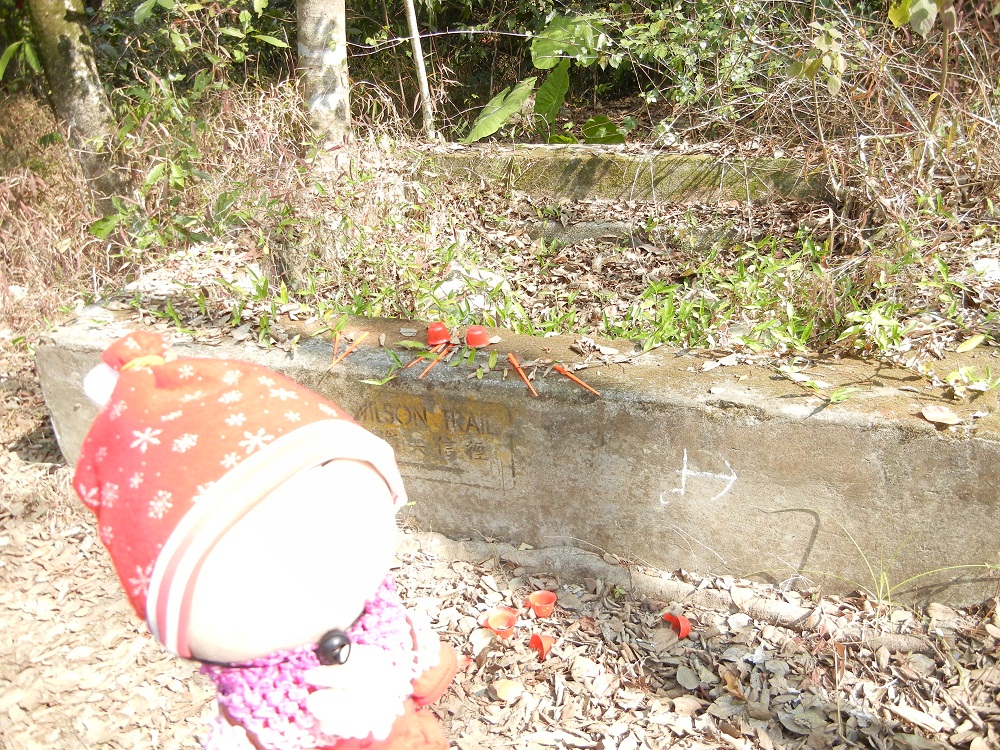

到了W134, 已是下七木橋. 不過, 古村早已消失, 只找到有屋架.
J
Here we are @ W134 (Wilson Trail), this is already Lower Tsat Muk Kiu. But as the old village is already disappeared, we could only find part of a collapsed village house here.


到了W133, 已是上七木橋. 古村早已消失, 只找到昔日引水用的水道.
J
Here we are @ W133 (Wilson Trail), this is already Upper Tsat Muk Kiu.
This village also disappeared, no traces at all. We could still see something like catchwater, used in the past to direct stream water from the hillside to the village for crop-growing.


向橫山腳的方向去. 中途有美麗的林區, 四處都是蟲鳴. 過橋後會看到 W131 標柱, 即是已進入橫山腳村落的範圍.
J
Moved to the way to Wang Shan Keuk. There're beautiful forests everywhere, with the lovely "songs" from the insects.
Cross the bridge and you'll see distance post W131, which means you've entered the village area of Wang Shan Keuk.


部份隊友改道至黃嶺, 我們繼續步向八仙嶺. 途中有清涼的竹林, 一解悶熱.
J
Some of the team members moved to Wong Leng. The others continued the way to Pat Sin Leng. We passed through a big bamboo forest which made us much cooler during the noon-time.


穿林過河再過橋. 河邊有警告牌, 叫大家不要捕捉野生龜!! 原來這裡有野生龜! 不過, 一隻也看不見!! 此橋名為"橫山腳南橋", 昔日供村民出入使用.
J
Walked through forests, streams and bridge! There's a warning sign to warn people NOT to catch wild turtles here!
Can't imagine there are wild turtles living around this place!! A pity we didn't see even one!!
The bridge is called "Wang Shan Keuk South Bridge", which is for the villagers living here in the past.
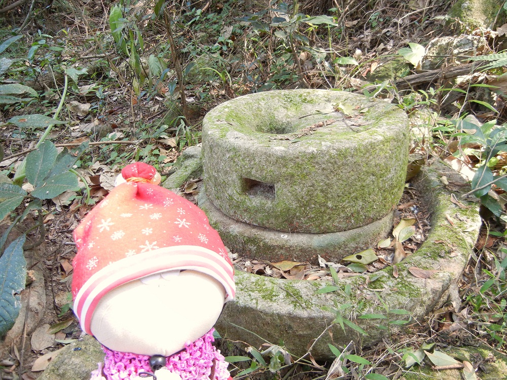


到了昔日的"橫山腳上村". 村落已荒廢, 我們仍有幸在林中找到古舊石磨, 還有快倒塌的"林氏宗祠" (原來此村是林姓的村民所有的). 村屋被大量樹木所掩, 很有鬼屋味道.
J
We had reached "Upper Wang Shan Keuk Village"~ the village is abandoned, and we were so lucky to find out an old grinder from the forest.
And also took some photos for an old house, Lam's Ancestral Hall (The villagers here in the past with the family name "Lam"), which is very old and may fall down any time!!


步進旁邊的"橫山腳下村", 內有些破舊村屋, 拍照後便向大尾篤方向步去.
J
Then we arrived a village nearby, which was called "Lower Wang Shan Keuk Village". There are some old village houses inside.
We took some photos and then moved to the way to Tai Mei Tuk.


往大尾篤的山路又長又斜, 非常費力.
J
The mountain path to Tai Mei Tuk is quite exhausting for us!! Really long and steep...


有小路可上至八仙嶺看"仙姑峰", 但大家都已太累, 只好下山至大尾篤. 不過在林中看到"船灣淡水湖", 又振作起來.
J
There's a path leading to the top of Hsien Ku Fung (One of the hills of Pat Sin Leng), but we were too tired to go up.
So we decided to walk downwards to Tai Mei Tuk for dismissal. But when we saw the beautiful Plover Cove Reservoir from the hillside, we couldn't stop taking photos!


最後一段下山路.... 鬆一口氣!! 終於到達山腳的"春風亭", 一座為紀念1996年八仙嶺山火的死者而建立的小亭. 我們剛走過小段當日意外發生時的路,
難以想像他們遇上山火時的絕望, 山路不好走, 遇上山火真的很可怕!!
J
Now we were at "Spring Breeze Pavillion", which was built for the memorial of the deceased teachers and students in the "Pat Sin Leng mountain fire" in 1996.
The fire started near the path we had walked through earlier. The trail is steep and long, we can't imagine how hopeless they were when the fire had taken place. Hope them rest in peace.

仙姑峰在此! 當日山火後, 死難者就在附近的山坡上被尋回. 山火真的很可怕!!
J
Here's Hsien Ku Fung!! The victims were found along the path of this hill!! Mountain fires are really horrible!

離開八仙嶺了, 笑一笑吧!!
J
Cheers! Tachibana san! Now we were leaving Pat Sin Leng!


今天走過的路徑~ 由定向柱20 (橫山腳上, 下村) 開始走到1, 沙頭角那一段未計入內. 今天全程大約是8~8.3 公里.
J
The map is showing the way we walked (The part for Sha Tau Kok is NOT included), starting from Wang Shan Keuk area.
The total distance from Sha Tau Kok to Tai Mei Tuk is around 8~8.3 km
沒有留言:
張貼留言